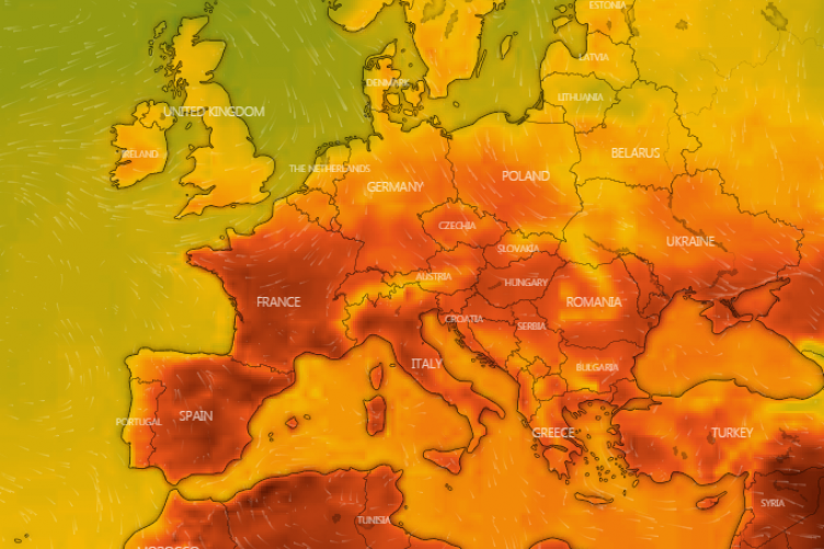
Hottest day of the year so far recorded with 27.5C at Heathrow
London sweltered in the heat, with temperatures beating the previous high for the year so far, which was 23.6C in Faversham, Kent on May 6.
Forecasters at the Met Office had predicted the weather will be “dry and very warm [with] sunny spells” across central and eastern parts of the UK.
But, they said, the hot weather will give way to clouds and heavy rain in the west later in the evening, spreading into central areas of the UK.
The Met Office’s Richard Miles said the warm temperatures were “largely confined to the south-east of England”.
But he added that the weather is expected to “generally be cooling” from Wednesday until the weekend, when temperatures will be “about the average for the time of year”.
Mr Miles said: “Obviously the warmest temperatures of the year so far, it is largely confined to the south-east of England; other areas will be generally fine but not quite as warm.
It’s now the warmest day of the year so far as temperatures have climbed to 27.5°C at Heathrow 🌡️ pic.twitter.com/kbWakBdCJi
— Met Office (@metoffice) May 17, 2022
“There is a risk, certainly today, of quite a bit of rain around. Tomorrow, drier, although there will be some convective showers.”
He added: “The main reason for the warmth will be the higher pressure of the continent which is where the plume of warmer air will reach into the south of the UK, so it is basically a warm air flow from the continent to the south, but it is being pushed further eastwards then maybe it looked last week.”


